Camarillo and Oxnard Stations Americans with Disabilities Act (ADA) Improvement Projects
Camarillo Station ADA Improvement Project
What is the Camarillo Station Americans with Disabilities (ADA) Improvement Project?
The Camarillo Station ADA Improvement Project aims to bring the station into full compliance with the Americans with Disabilities Act (ADA) standards. The scope of work includes, but is not limited to ramps, accessible pathways, signage, and other ADA-compliant facilities. The project is expected to improve accessibility for all users at the station, particularly individuals with disabilities.
What is the Project Schedule?
VCTC and the City of Oxnard are leading Americans with Disabilities Act (ADA) improvement projects for two rail stations, Oxnard and Camarillo that are served by two passenger rail systems – Metrolink and Amtrak. The Metrolink rail system is managed by the Southern California Regional Rail Authority (SCRRA/Metrolink) and Amtrak Pacific Surfliner system is managed by LOSSAN Agency. The ADA modifications at these two stations will be designed and implemented to ensure that all passengers with disabilities can access the train cars.
What is Accessible Boarding?
Level boarding refers to the alignment of train platforms and train floors at the same height with minimal horizontal gap, allowing passengers to board without needing steps or lifts. This helps passengers with mobility devices, strollers, and luggage board easily and safely.
What is the purpose of the Accessible Boarding Method?
The Federal Railroad Administration (FRA)/Federal Transit Administration (FTA) require that when a public entity constructs a new facility for use in designated public transportation or alters an existing facility or a part of such a facility, the entity must make the alterations in such a way that the altered part of the facility is readily accessible to and usable by persons with disabilities.
Essentially, the federal regulations require that the boarding platform height be the same as the train car door height, OR the rail agency may request approval for an alternate method that serves as an “Equivalent Facilitation.” VCTC and the City of Oxnard is proposing to meet the performance standard through alternative boarding methods and equivalent facilitation.
What is the Project schedule for the Accessible Boarding Method Report?
How can I provide comments?
VCTC and the City of Oxnard will be providing the following opportunities for the public to submit questions or comments:
Virtual Public Presentation | October 17, 2024 at 12:00 PM via Microsoft Teams
Meeting ID: 271 589 659 880
Passcode: BCd2NZ
Dial in by phone
Phone conference ID: 210 542 138#
And:
VCTC Commission Meeting | December 6, 2024 at 9:00 AM located at the Camarillo Public Library (4101 Las Posas Rd., Camarillo, CA 93010)
You can submit any questions or comments related to the Camarillo and/or Oxnard Stations at: AccessibleBoarding@goventura.org.
Resources
Bicycle Safety
BIKE
Bicycle Safety
Who doesn’t love to ride a bike? It’s fun, healthy and a great family activity. It’s also a green alternative to driving. But before you jump on your bike, here are some tips to make sure you and your family are ready to ride safely!
Before you leave the house, get prepared. Plan your route, check your equipment and follow these simple tips.
- Always wear a bicycle helmet. This is important for everyone at every age, but for riders under the age of 18, it’s the law.
- Be alert. Keep your eyes and ears open. Don’t use your cell phone or wear headphones while you ride.
- Be visible. Make sure that drivers can see you coming by wearing bright clothing and using lights and reflectors.
- Practice defensive riding. Scan the road ahead so you can steer clear of hazards. Be ready to brake or change course to avoid cars, pedestrians, potholes or debris in your path.
Under the California Vehicle Code, bikes are considered a vehicle. For the most part, cyclists have the same rights and responsibilities as motor vehicle drivers.
-
- Motorists and cyclists follow the same rules of the road. Motorists must yield to bikes as they would to any other vehicle.
- Always bike with the flow of traffic. If you’re traveling as fast as traffic, you can ride in any vehicle lane you’d like. Ventura County does not allow riding on the sidewalk in business areas or where signs say no riding.
- Motorists must give cyclists three feet of space. If there is not enough room for a bike and a vehicle to safely travel side by side, cyclists are entitled to use the entire lane, no matter how fast they move.
- If you’re going slower than the speed of traffic, you must use a bike path (if there is one) or hug the right shoulder of the vehicle lane except when making a left turn, passing or avoiding hazards.
Be a safety role model for the young people in your life. Make biking safe and fun for the whole family by following these guidelines.
- Make sure that child carriers – like bike trailers and bike seats – are highly visible and installed correctly according to the manufacturer’s instructions.
- Children under the age of 18 are required to wear helmets. Don’t let your child ride a bike without a helmet that fits well and is properly secured. .
- Supervise children on bikes at all times. Never let kids ride alone.
- Whenever possible, use protected bike paths, also known as Class 1 bike paths, which are completely separate from city streets. Visit VCTC’s Regional Bike Map to find Class 1 bike paths in your area.
Ventura County Comprehensive Transportation Plan
Ventura County Comprehensive Transportation Plan
What is the Ventura County Comprehensive Transportation Plan?
The Ventura County Comprehensive Transportation Plan (CTP) is a long-range planning document adopted by the Ventura County Transportation Commission (VCTC) that plans for the future of transportation in the County over the next 20-30 years. The 2023 CTP incorporates socioeconomic data, community priorities, and local transportation solutions while also placing a special emphasis on inclusion of disadvantaged and underserved communities to create a more equitable transportation future for all.
What is the purpose of the Plan?
The Plan:
- Identifies future transportation needs, priorities, and funding
- Identifies strategies to reduce emissions and improve air quality
- Enhances equitable access to mobility options
- Establishes a vision for mobility in Ventura County for the next 20-30 years
Recent community comments are being incorporated and the final Plan will be available by February 3.
English:
Spanish:
How will the Plan be used to improve Ventura County?
The Plan will:
- Provide a comprehensive look at transportation across Ventura County
- Consider future land use and transportation conditions
- Identify community‐based transportation priorities
- Help Ventura County meet State and local mandates and goals
What’s the project location and scope?
The Plan includes all transportation modes throughout Ventura County and will analyze walking, biking, transit, rail, freight, airports and more.
What role will the public and stakeholders play in the planning process?
The CTP update will be guided by input received from the community and project stakeholders. Two online surveys will be made available in English and Spanish during the project to solicit input from the community. Additionally, members of the project team will be visiting community events to connect with community members and get feedback.
The project will also include the formation of a Regional Advisory Committee and several Local Advisory Committees that will be engaged at different stages of the plan’s development. The committees will include representatives from major institutions and employers in Ventura County, such as local universities, Naval Base Ventura County, the Port of Hueneme as well as educational, business, and environmental representatives.
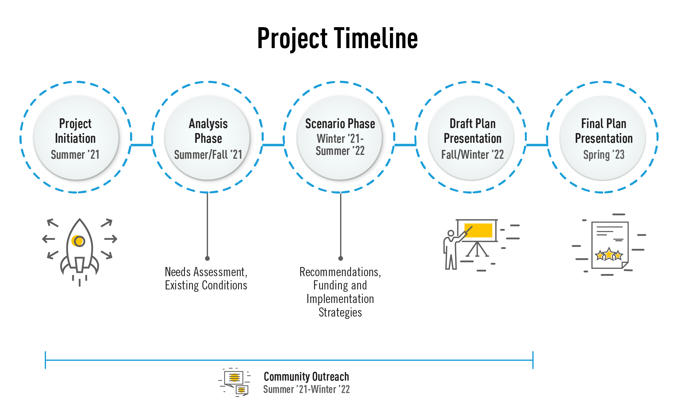
What is the Project Schedule?
Thanks for your feedback
Over the past year, we have heard from hundreds of community members with their thoughts on the future of transportation. The accepted Comprehensive Transportation Plan is available here here. In February 2023, the VCTC Board voted to accept the CTP and provided direction to staff to amend the plan to incorporate comments from the public and advisory committees for full adoption at a future date. If you would like updates on the CTP timing and amended plan, please sign up for the project email list below.
Virtual Community Workshop
A virtual public workshop was held on December 6th at 6:00 pm and if you were unable to attend, video recordings in English and Spanish are below. We welcome your feedback!
Meeting Slides English | Spanish
Meeting Recordings English | Spanish
If you have any questions or comments, please contact:
To sign up for the project email list, please submit your email below:
How is this plan related to the Our Future 101, 101 Communities Connected, and the Ventura County Freight Corridors Study Projects?
Our Future 101 is an alternatives analysis and environmental assessment for highway improvements on the mainline of the freeway. These include, for example, adding regular, carpool, or auxiliary lanes and ramps.
101 Communities Connected examines more than just the U.S. 101 freeway, and takes a more general and high-level view of the broader three-mile radius around the 101 to develop a list of potential multimodal improvements for highway, transit, bikes and pedestrians, which is coordinated to provide the most efficient overall mobility for all County residents that use the corridor.
The Ventura County Freight Corridors Study project looks at freight connections beyond US 101 such as the regional highways of State Routes 1, 23, 33, 34, 118, 126, and 150, including primary and arterial roadways as well as, connections outside the .
The Transit Integration and Efficiency Study (TIES) launched in early 2021 to review transit operations and structure in Ventura County. The goal of the study is to improve bus transit throughout Ventura County by identifying strategies that will most effectively improve passenger experience, reduce operating and capital costs, and better integrate the existing operating systems.
All of the studies analyze different aspects of the transportation system, and the CTP will bring together these different areas and evaluate the transportation network as a whole. We look forward to keeping you informed about the Ventura County Comprehensive Transportation Plan.
Is the previous Comprehensive Transportation Plan available?
The 2013 plan may be viewed here.
VC Freight Corridors Study
What is the Ventura County Freight Corridors Study?
VCTC, the Port of Hueneme, and Caltrans have partnered with the Southern California Association of Governments to develop the Ventura County Freight Corridors Study, which will identify and prioritize the most significant freight corridors for safer, more efficient, and sustainable freight connections. We will work with community and industry groups and the general public to refine the project objective, focus analysis efforts, and develop solutions with the greatest benefit to both the County’s economic competitiveness and environmental health.
What is the purpose of the Study?
The Ventura County Freight Corridors Study will establish a more thorough understanding of the highway freight corridors in Ventura County, along with key related local roads, and use the knowledge to inform future highway planning and investment decisions. It will identify opportunities to support cleaner freight and goods movement, while continuing to promote Ventura County’s industries, including the strong agricultural economy, as well as the region and State’s economic growth.
It will assist the Port of Hueneme and the Ventura County region to move towards achieving State and regional emission reductions goals and increase social equity by planning for a transportation system that is efficient but not disproportionately centralized around disadvantaged communities.
How will the study be used to improve Ventura County?
The Ventura County Freight Corridors Study will bring together a range of community, industry and public agency voices to develop a consensus-driven plan that identifies steps to improve the safety and efficiency of freight movement throughout Ventura County and the region.
What does it mean for my community?
Long-range transportation infrastructure decisions require careful study of an assortment of issues to preserve and improve the existing roadway network with solutions that will ensure future investments yield the greatest sustainable benefit to the County’s economic competitiveness and growth as well as human and environmental health.
The Ventura County Freight Corridors Study was adopted by the Ventura County Transportation Commission on November 5, 2021. A copy of the Study is available to download here. Ventura County Freight Corridors Study Final 10-26-21.pdf
Watch a previously recorded Public Workshop
Public Workshop #1: Project Goals and Existing Conditions (held on February 18, 2021)
Public Workshop #1 (English)
Public Workshop #1 (Spanish)
Public Workshop #2: Issues, Vulnerabilities and Opportunities, and Performance Measures (held on March 18, 2021)
Public Workshop #2 (English)
Public Workshop #2 (Spanish)
Public Workshop #3: Draft Presentation (held on September 16, 2021)
Public Workshop #3 (English)
Public Workshop #3 Slides are available here (English)
Public Workshop #3 (Spanish)
Public Workshop #3 Slides are available here (Spanish)
How is this study related to the Our Future 101 and 101 Communities Connected Projects?
Our Future 101 is an alternatives analysis and environmental assessment for highway improvements on the mainline of the freeway. These include, for example, adding regular, carpool, or auxiliary lanes and ramps. 101 Communities Connected examines more than just the U.S. 101 freeway. It takes a more general and high-level view of the broader three-mile radius around the 101 to develop a list of potential multimodal improvements for highway, transit, bikes and pedestrians, which is coordinated to provide the most efficient overall mobility for all County residents that use the corridor.
Due to the amount of recent focus in the US 101 Corridor already, the Ventura County Freight Corridors Study project will look at freight connections beyond US 101 such as the regional highways of State routes 1, 23, 33, 34, 118, 126, and 150, including primary and arterial roadways as well as, connections outside the County.
What other transportation planning efforts studied freight in Ventura County?
Past Studies of freight in Ventura County focused on access to the Port of Hueneme in the Port of Hueneme Access Study (2000) and Cities of Port Hueneme/Oxnard Truck Traffic Study (2008).
Ventura County’s roadmap for future investment in the transportation system is the Ventura County Comprehensive Transportation Plan (2013). An update to the Comprehensive Transportation Plan is slated to begin in 2021, and will consider the results of the Freight Corridor Study, 101 Connected Communities, and Our Future 101.
The State of California provides a vision for the future in freight statewide in the California Freight Mobility Plan and the California Sustainable Freight Action Plan.
Download the Ventura County Freight Corridors Study
Why is Goods Movement Important?
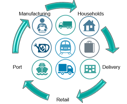
Products are moved from where they are grown, extracted and manufactured to consumers. Our society needs an effective goods movement system to transport the products grown or made in Ventura County to markets around the world.
Ventura County residents and businesses consume goods imported or delivered from other parts of the Country. These goods are organized at warehouses for delivery to stores, businesses and households.
The agricultural industry, manufacturing, wholesale, and transportation industries generate 1/3 of the County’s economic output and employ over 60,000 people.
Tell us how freight affects your life in the comment box below.
Goods Movement in Our Communities
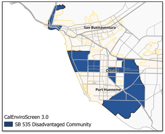
Goods are transported on the road and rail system through every community in Ventura County. As we look to the future, we must consider disadvantaged communities currently burdened by high levels of pollution and focus investments to improve public health, quality of life and economic opportunity in these burdened communities.
The State defines the most pollution-burdened communities in Ventura County as located in the eastern and western portions of Oxnard and western Ventura. This study will take careful consideration of transportation investment to improve health and social outcomes for our vulnerable populations.
Tell us what transportation system investments would improve your community in the comment box below.
Safety in Rail Corridors
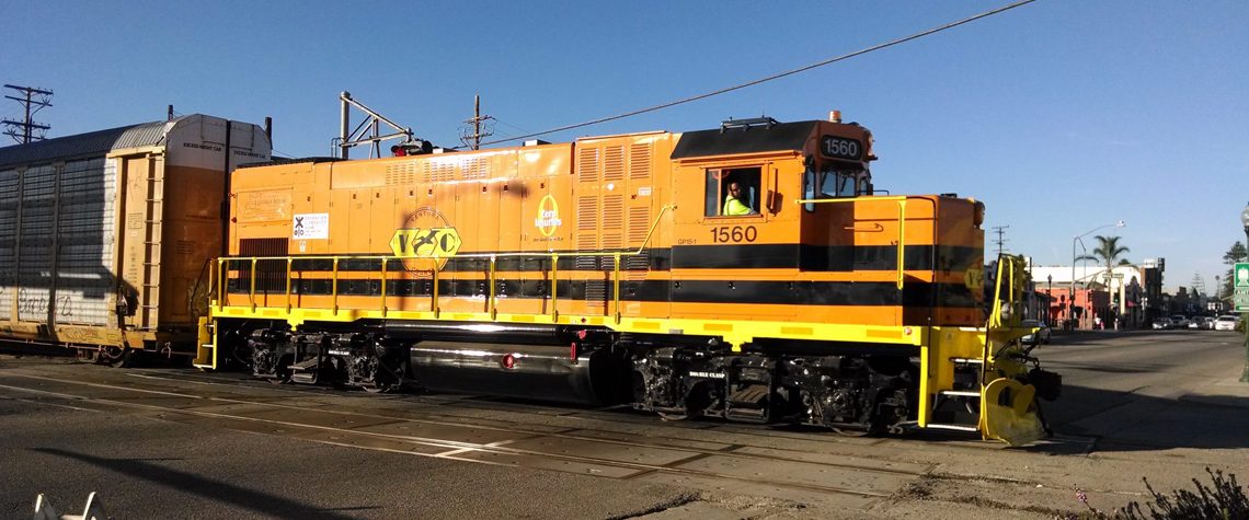
Ventura County is bisected by Union Pacific/ Metrolink rail tracks near US 101. There are 25 crossings of the rail tracks in the 20 miles between Ventura and Camarillo—12 of which are above or below the tracks and 13 are at-grade with the tracks.
Incidents in rail corridors happen at:
- Highway-rail at-grade crossings between trains and vehicles, pedestrians and bicycles
- Trespassers on the rail tracks (primarily pedestrians)
In the past five years, there were 24 incidents at highway/rail crossings and 44 trespasser incidents which resulted in 63 injuries and 34 fatalities.
Tell us where you cross the rail tracks and where crossings can be improved or created in the comment box below.
Schools and Parks
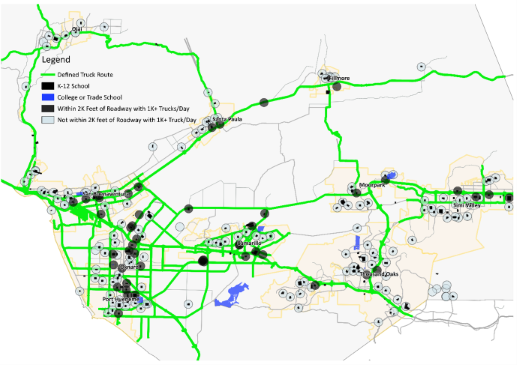
More than half of schools in Ventura County are within 2,000 feet of a truck route—and 24 schools are located directly on a truck route.
Ensuring safe and deliberate support of walking and biking access to schools and parks across routes supporting large amounts of truck traffic is an important strategy to balance community interest with freight movement.
Tell us which community crossings can be improved in your neighborhood in the comment box below.
Truck Parking
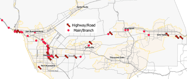
Ventura County has a shortage of truck parking: there are only nine publicly available truck parking spaces in Ventura County. The next closest truck parking facilities are located 45 miles away in Castaic along I-5.
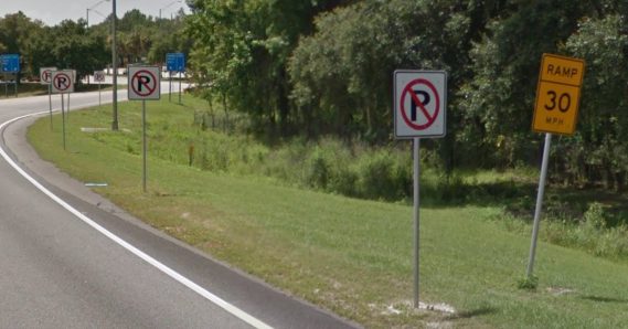
Truck operators have strict rules for work hours and are forced to find parking within a few miles of ‘timing-out’. With public facilities out of reach, trucks are forced to park along roadways not designated or designed for shoulder parking.
Typically, commercial truck parking is made available at public rest areas, truck stops, at highway weight stations or in designated areas along highway roadsides.
Tell us where trucks should safely park in Ventura County in the comment box below.
Did you know a major freeway connection is missing in Ventura County?
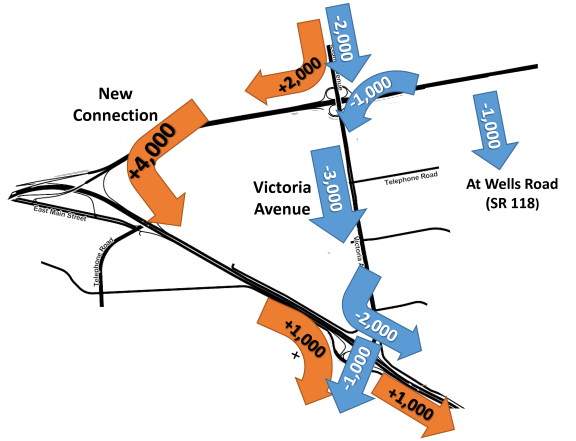
There is no direct connection from Westbound SR-126 to Southbound US 101.
Vehicles must utilize Victoria Avenue to make the connection. A new connection would shift traffic patterns to keep more vehicles on freeways and off local streets.
A modeling analysis indicates 4,000 vehicles per day would shift from to the new southbound connector.
Tell us about your experience driving these roads in the comment box below.
How is Freight Moved in Ventura County
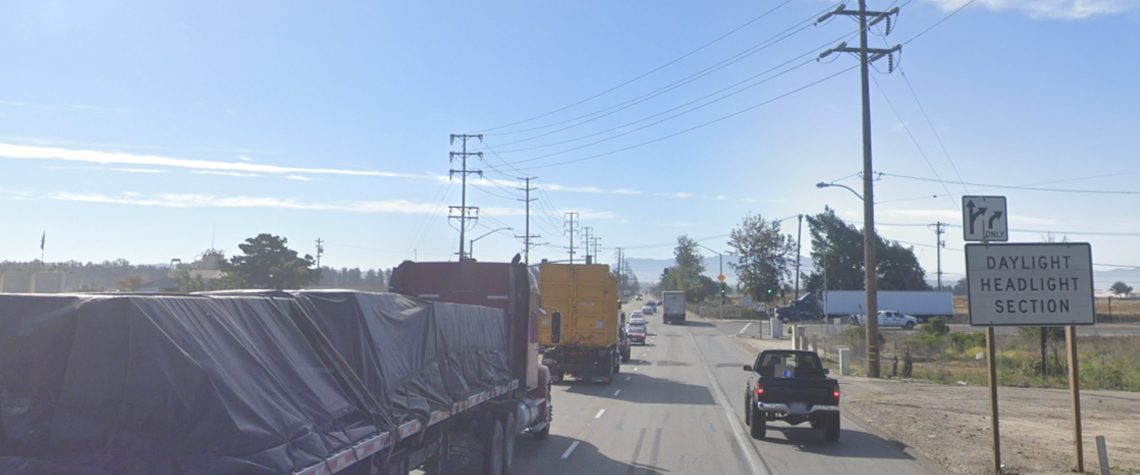
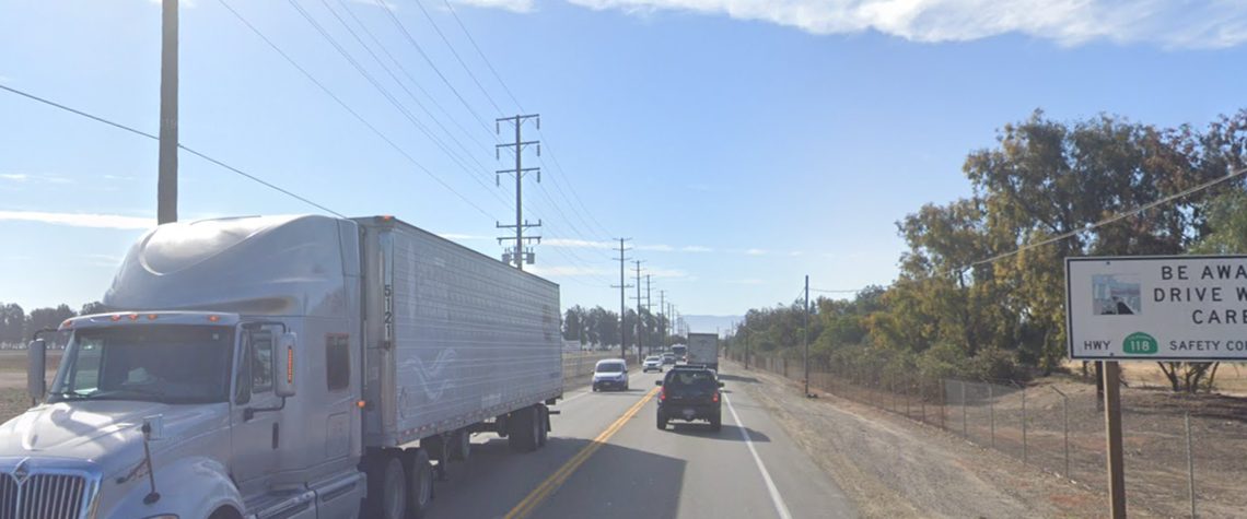
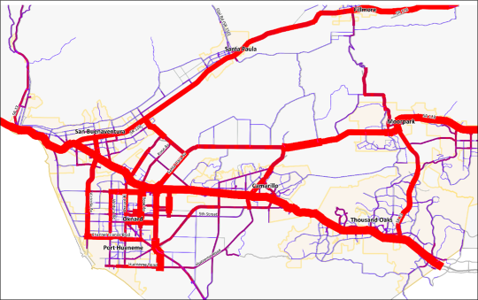
Whether it is a truckload of strawberries, a container from the Port of Hueneme, a parcel delivery or construction materials, goods flow to where they are needed. Trucks concentrate on the major east-west highways of SR 126, SR 118 and US 101 and the streets in and around the City of Oxnard.
The agricultural industry, manufacturing, wholesale trade, and transportation and warehousing industries generates approximately 1/3 of the County’s economic output and employs more than 60,000 people.
The trade activity through the Port of Hueneme (Oxnard Harbor District) generates nearly $1.7 billion in economic activities in the immediate region providing over 15,000 direct and indirect jobs.
Have you received a shipment recently? Did you wonder how and where it was transported from? Tell us about your thoughts on freight movement in the comment box below.
Zero Emissions Vehicles and Goods Movement
Transitioning vehicle fleets to zero tailpipe emissions is a major component of eliminating diesel engine pollution and greenhouse gas emissions. Diesel pollution impacts health, especially in disadvantaged, low-income, and rural communities living along or near major freight corridors in Ventura County.
Electric and hydrogen fuel-cell electric trucks, buses, and vans already are being adopted by fleets that operate. These vehicles are well suited to operating in congested urban areas with stop-and-go driving where diesel engines are the least efficient.
The Ventura County EV Ready Blueprint is intended to accelerate and support electric vehicle and charging infrastructure deployment throughout Ventura County. The Port of Hueneme is committed to sustainable growth through programs and initiatives in an environmental framework.
While there are several technical challenges in the conversion to a zero emission fleet, it is an important step to improving community health while supporting economic growth.
Tell us how shifting to a zero-emission heavy-duty truck fleet would improve your life in the comment box below.
The SR 118 Corridor
While US 101 is the route with the shortest travel time for south Los Angeles County, and SR 126 is the fastest route to/from I-5 and connections to Northern California, State Route 118 is the fastest route from the San Fernando Valley.
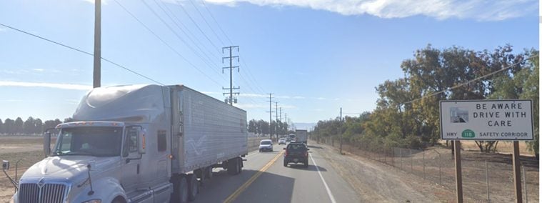
Approximately 1,000 trucks per day travel in each direction near Somis. Many travel between Ventura County and points east via the San Fernando Valley. Trucks avoiding the Conejo Grade and the major commercial vehicle enforcement facility along US 101 also use SR-118 as an alternative.
The character of SR 118 changes through the County: as a freeway in the Simi Valley to Los Angeles Avenue through Moorpark to a rural two-lane highway from Somis to Ventura.
With collision hot-spots near Balcom Canyon Road, Grimes Canyon Road, and Santa Clara Avenue, the two-lane rural section has a need for safety improvements. Upgrades to signage, turning lanes, and horizontal curve improvements are potential options to prioritize safety in the corridor.
Tell us improvements you would make along SR 118 in the comment box below.
Port and Navy Base Access
The Port of Hueneme is a shared use port with Naval Base Ventura County (NBVC) and the Port of Hueneme: a strategic deep-water seaport and National Defense Resource.
Two-way trade activities through the commercial Port are valued at $10 billion and generated nearly $1.7 billion in economic activities in the immediate region providing over 15,000 direct and indirect jobs.
The majority of the Port’s business (60 percent) is the import and export of automobiles and other vehicles. Approximately 300,000 autos and 50,000 high-and-heavy units are processed through the Port annually. Other goods processed through the Port are fruits, vegetables and seafood; liquid bulk fertilizer; and industrial fluids.
The Port Intermodal Corridor was established in 1998 to facilitate truck access between the Port and US 101. The primary corridor route is Hueneme Road to Rice Avenue to the Rice Avenue interchange at US 101. The contingency corridor serving the Port is Ventura Road to Channel Islands Boulevard to Victoria Avenue to the Victoria Avenue interchange with US 101.
NBVC uses local roadways for military mobilization of troops and equipment to and from the base and have designated roadway mobilization corridors on Victoria Avenue to US 101 and Hueneme Road to Rice Avenue to US 101 (both on the Port Intermodal Corridor) and a rail mobilization corridor from South Patterson Road to East Wooley Road to State Highway 1.
Do you travel on the port access and mobilization corridors too? Tell us about your experience in the comment box below.
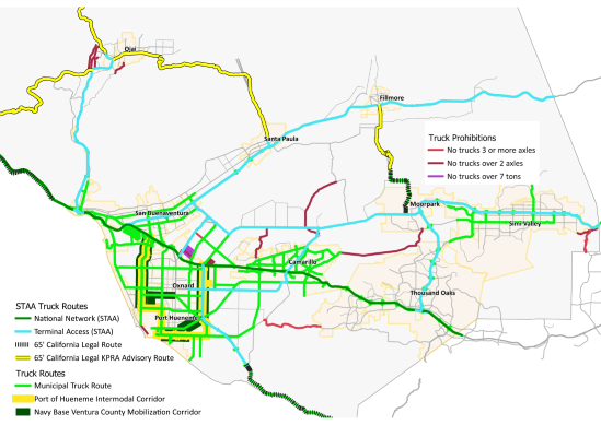
Truck Routes
The roadways in Ventura County are under the ownership and maintenance by different government agencies.
These agencies are allowed to limit large vehicles to defined truck routes or prohibit large vehicles based on weight and length. Signage and identification of truck routes are limited and can lead to confusion as to where truck can travel in the County.
The Freight Corridor Study is looking at locations where improved identification of truck routes to keep trucks on the best routes to their destinations.
Are truck routes clearly identified on the roads you use? Share your thoughts on truck routes in the comment box below.
